Core Nickel Corp. (CSE: CNCO) (“Core Nickel” or the “Company”) is pleased to announce that Geotech Ltd. has commenced helicopter-borne geophysical surveys, including time domain electromagnetics (VTEM) and horizontal magnetic gradiometer using the VTEM™ Plus geophysical system on the Company’s 100%-owned Mel and Odei River projects (the “Projects”) (Figure 1), as stated in the Company’s news release on January 27, 2025. The Projects are situated approximately 20 km to the northwest of Thompson, Manitoba, in the northern region of the Thompson Nickel Belt. The Projects are strategically located in proximity to infrastructure, including Provincial Highway 6, the HBR (Omnitrax) Rail Line and a major hydroelectric transmission line, offering excellent access for future development.
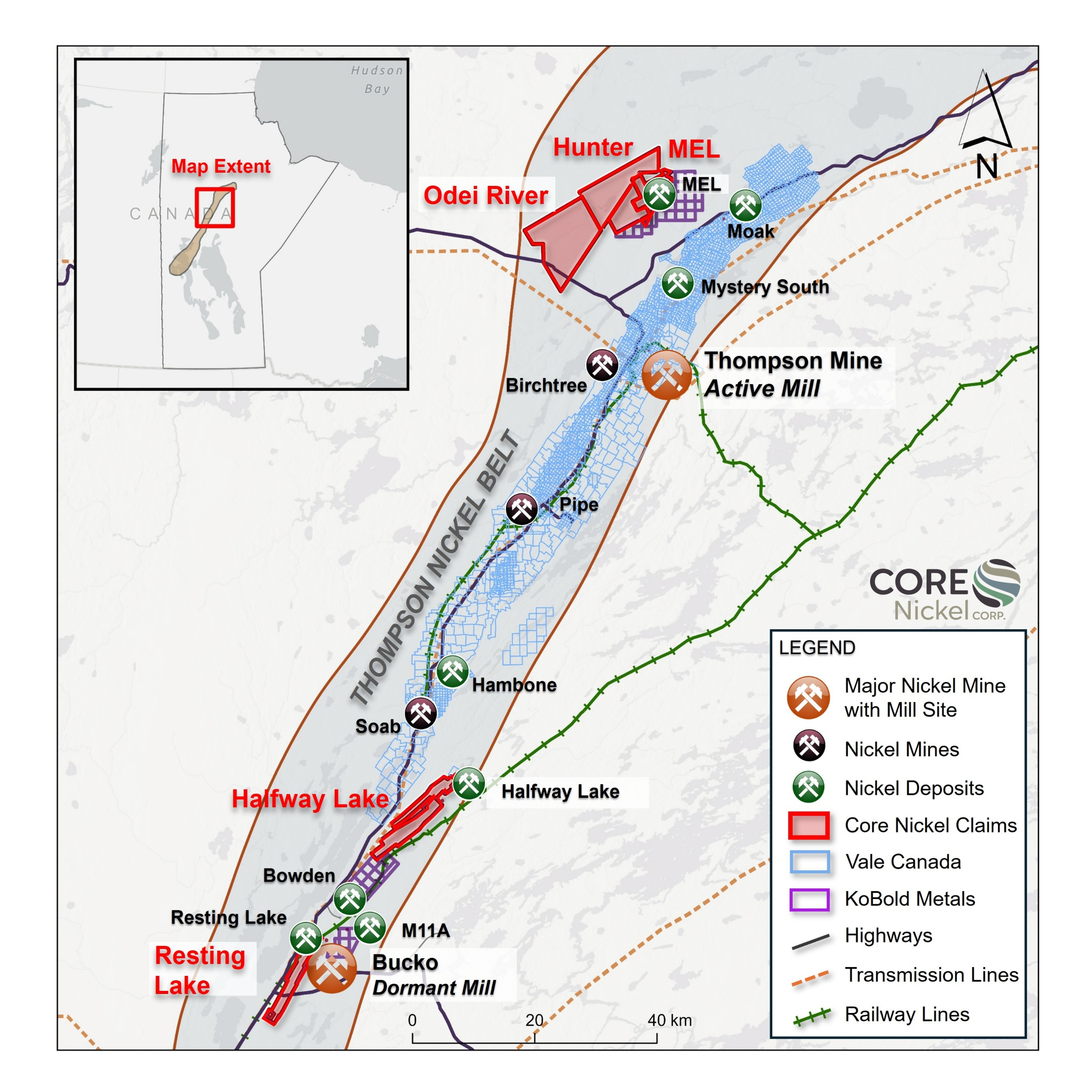
Figure 1 – Mel and Odei River Projects Location Map
The geophysical surveys will cover approximately 379 line-km on the Mel project and approximately 1,520 line-km on the Odei River project, with 100 m line spacing on both projects (Figure 2). The geophysical surveys will obtain both new coverage and refine historical EM survey results. Upon completion of the VTEM survey on the Mel and Odei River projects, the Company will have modern VTEM coverage across its entire project portfolio, enabling a more comprehensive and strategic approach to target prioritization and exploration planning. The helicopter-borne VTEM™ Plus system, which is known for its high-resolution imaging capabilities, is a versatile time domain electromagnetic system that is particularly useful for locating discrete conductive anomalies. Additionally, the system also contains a high-sensitivity cesium magnetometer-gradiometer for mapping geologic structure and lithology. The survey is being conducted by Geotech Ltd. of Aurora, Ontario, and under the guidance of Stephen Balch, of Balch Exploration Consulting Inc. of Rockwood, Ontario.
Continue at Core Nickel
—