Cascade Copper Corp. (CSE: “CASC”/FRA: 91O) (“Cascade” or the “Corporation”) is pleased to announce that it has mobilized a crew from Precision GeoSurveys to fly a helicopter-borne electromagnetic and magnetic survey at their Fire Mountain Copper-Gold Porphyry Project in Southwestern BC. The survey will cover approximately 44 square kilometres in area with 222 line kilometres of flying. Flight lines will be approximately 200 metres apart with the aircraft’s coil situated at 40 metres above the ground.
Shannon Baird, Cascade Copper’s Vice President of Exploration remarks “Although we did have some magnetics data at Fire Mountain, we felt that the addition of EM data would be absolutely crucial for modelling and assessing the porphyry-skarn system at Fire Mountain. Once the survey is completed and the data processed and verified, we will model the apparent resistivity and conductivity in 3D. This will give us some excellent areas to follow up with surface sampling and future drilling.”
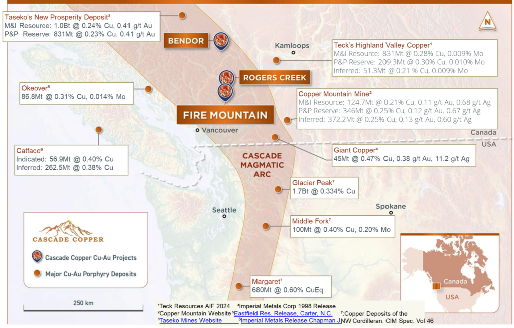
Figure 1: Location of the Fire Mountain Copper-Gold Porphyry Project within the Cascade Magmatic Arc showing locations of nearby porphyry and epithermal deposits.
Fire Mountain Project Location and Prospectivity
The Fire Mountain Copper-Gold Porphyry Project is a large, 56.85 square kilometre, potential “Flagship” project with significant surface assay results, intensive veining, and impressive alteration all highly indicative of a large porphyry-style hydrothermal system and related skarns. The Project is located approximately 13km south of the Corporation’s Rogers Creek Project within the Cascade Magmatic Arc.
Continue at Cascade Copper